Monitor surveyors’ attendance with geo-coordinates, photo logs, and real-time maps.

Register growers using CNIC/passbook validation along with field area and crop data.

Draw field areas manually or automatically — even offline — using mobile maps.

Avoid duplicate surveys and detect overlapping zones with built-in smart detection.

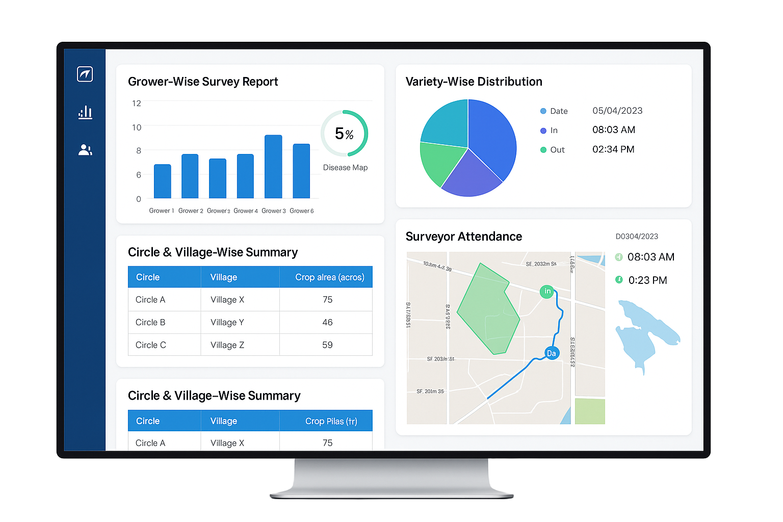
View circle-wise, grower-wise, and crop-wise reports. Audit or resend survey data as needed.

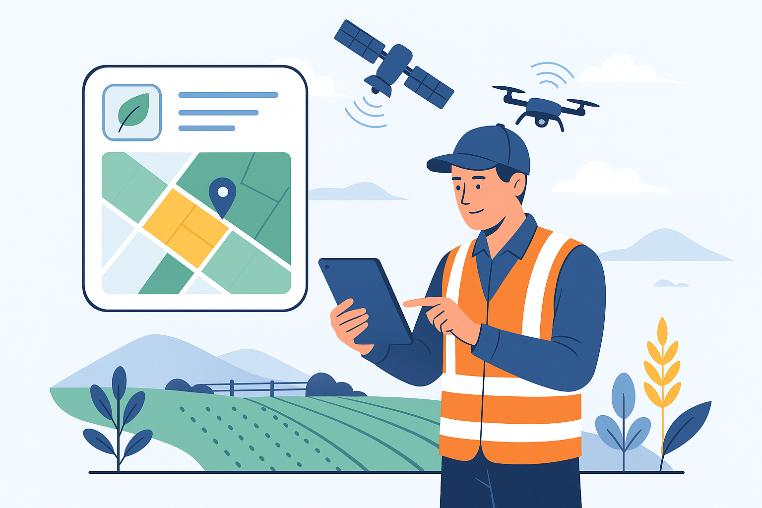
Use satellite imagery, NDVI/EVI indices, and dashboards to assess crop health & field visibility.

EagleEye is a next-generation survey management platform built for sugar mills and agribusinesses. It enables field teams to collect geo-tagged data, perform crop surveys, manage grower records, and monitor land health—all via Mobile devices and a centralized web portal.
Designed to work seamlessly with Cosmosoft’s SARP ERP Suite, EagleEye delivers actionable insights and full offline support, ensuring no field or grower is left behind.

Integrated with SARP Sugar ERP Suite
Works offline in remote field areas
Geo-tagged surveys & grower profiling
Visual reporting with MIS dashboards
Competitor field detection & crop health mapping

Define company coordinates, assign roles, and configure secure user access.
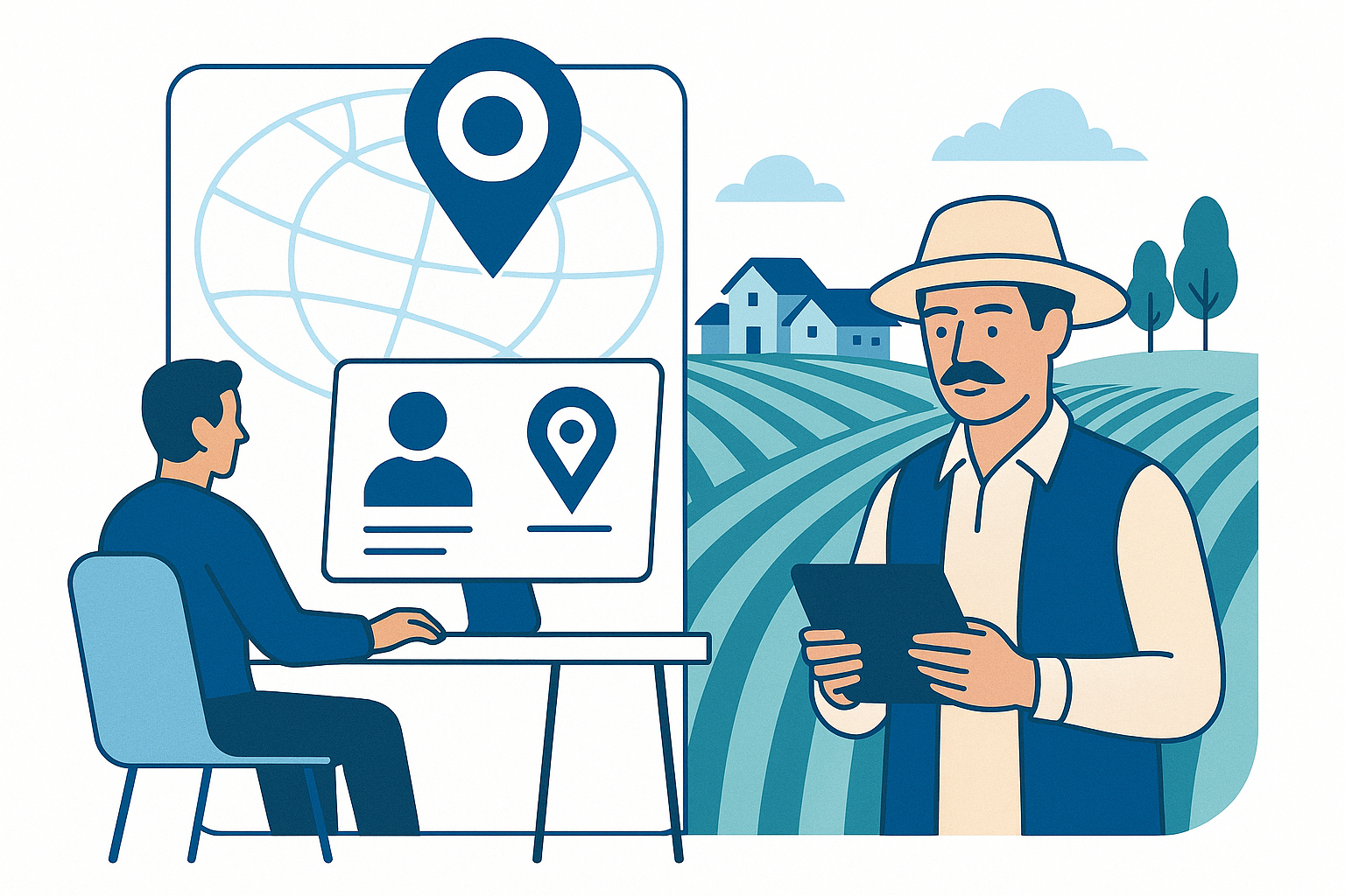
Tag circles and villages with GPS, add growers using CNIC/passbook, and define crop areas.

Surveyors draw field boundaries, select crops and diseases, and capture area data offline.

Prevent overlaps, review survey accuracy, and visualize data on MIS dashboards and maps.
EagleEye offers a rich suite of MIS dashboards that convert field survey data into meaningful insights. From grower-wise and variety-based analysis to GPS-based surveyor tracking and disease mapping, our dashboards empower sugar mill administrators to take real-time, data-driven decisions with confidence.
Grower-wise and Variety-wise summaries
Circle & Village-level crop statistics
Surveyor attendance and route tracking
Health index maps (NDVI, EVI) & overlapping field alerts
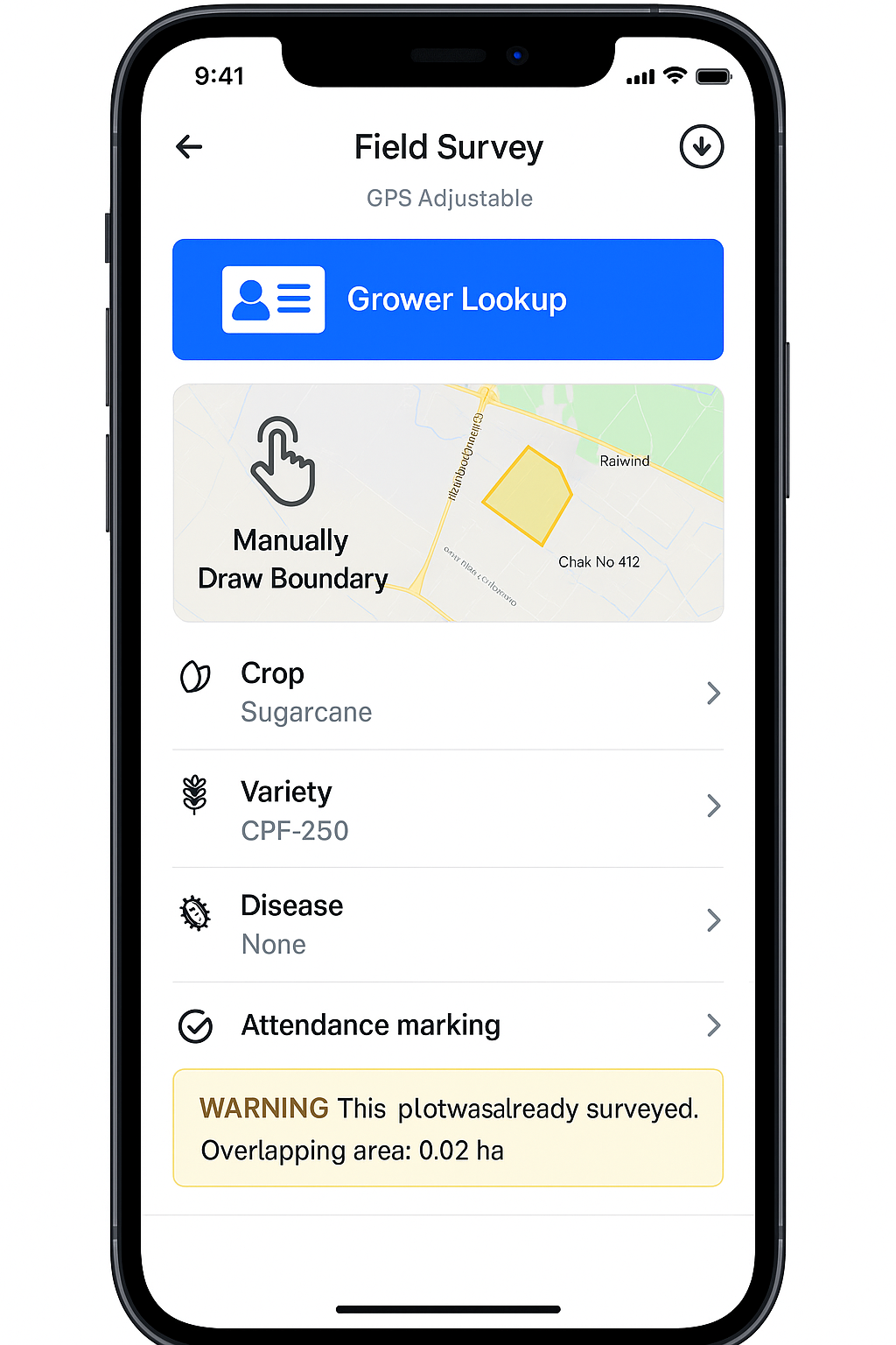
The EagleEye mobile app empowers field surveyors with a robust toolkit — even in remote areas with no internet. From offline syncing and grower lookup to field drawing and geo-tagged attendance, the app ensures that every data point is captured accurately and efficiently.
Offline field surveys with auto-sync on network
Grower lookup via CNIC or passbook
Draw field boundary directly on mobile map
Attendance marking with geo-coordinates
Already-surveyed plots warning & overlap prevention
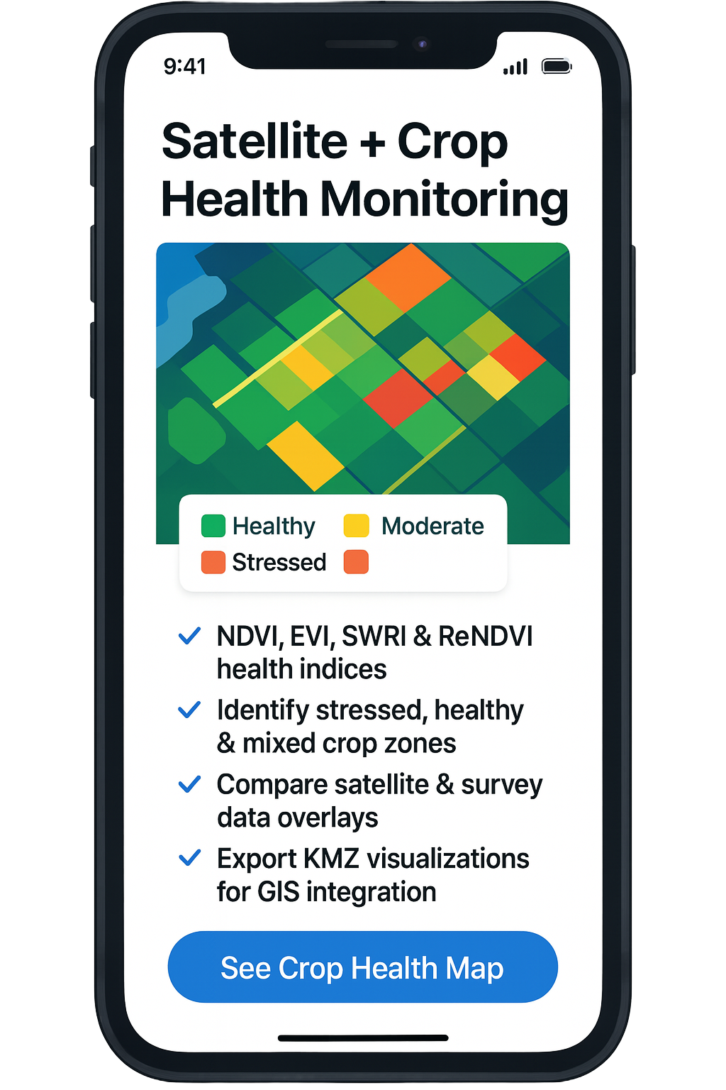
EagleEye blends remote satellite data with real-time ground surveys to deliver deep insights into crop health, stress zones, water needs, and growth patterns. By leveraging indices like NDVI, EVI, and SWRI, sugar mills can make smarter harvesting decisions and identify underperforming zones — even before visual symptoms appear.
NDVI, EVI, SWRI & ReNDVI health indices
Identify stressed, healthy & mixed crop zones
Compare satellite & survey data overlays
Export KMZ visualizations for GIS integration

Book a free consultation to explore how Cosmosoft can transform your operations with smart, scalable technology.
Schedule Now
Office No. 914 J-2 Block Johar Town (Near McDonald's)
Lahore, Punjab, Pakistan 54600
Phone:
+92 336 7239237
(+92) (0) 42 3545 5700
Email:
cosmosoftmarketing@gmail.com
marketing@cosmosoftsolution.com
© Cosmosoft. All rights reserved.